


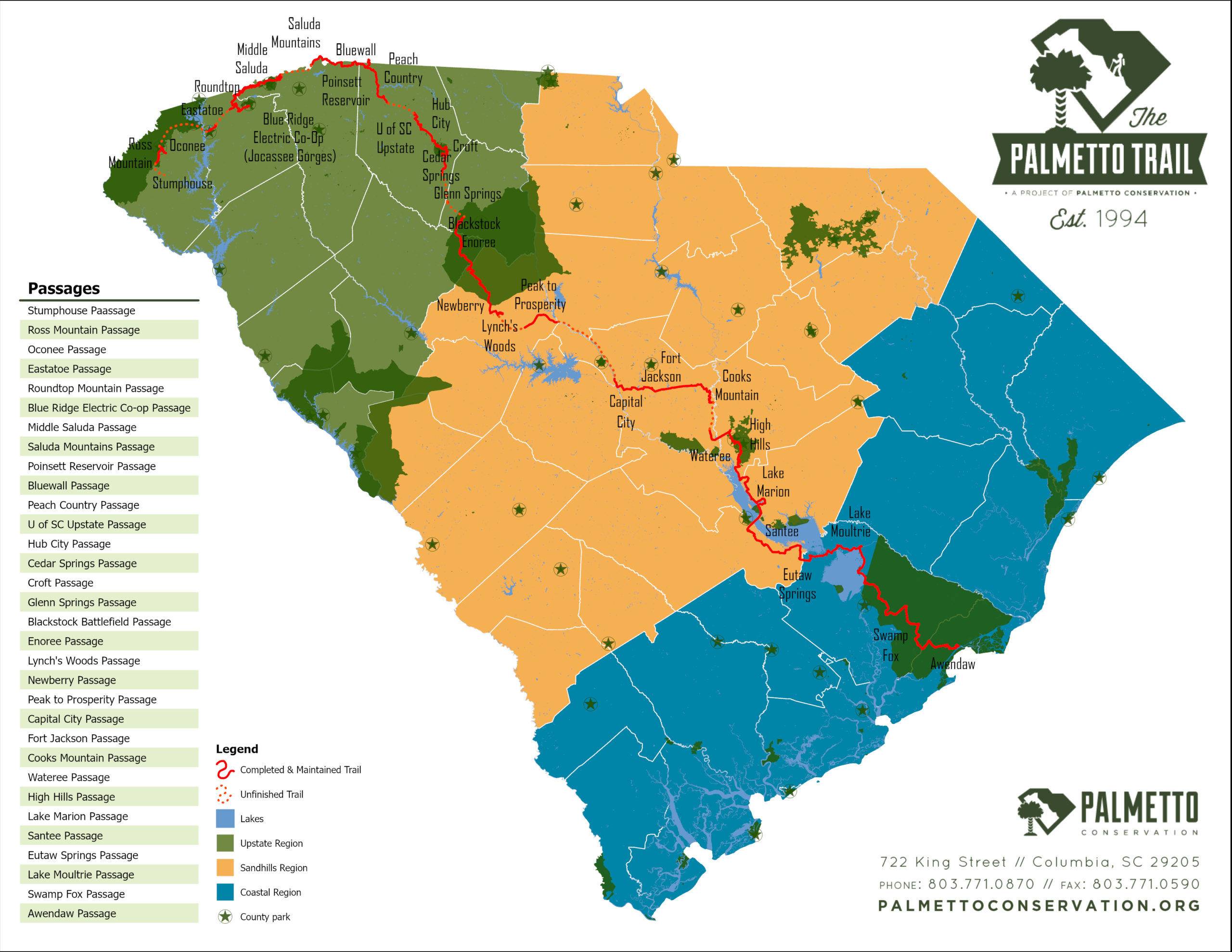
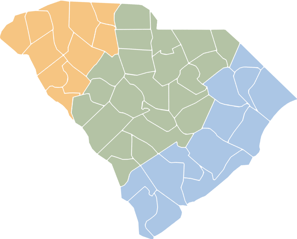
Passages
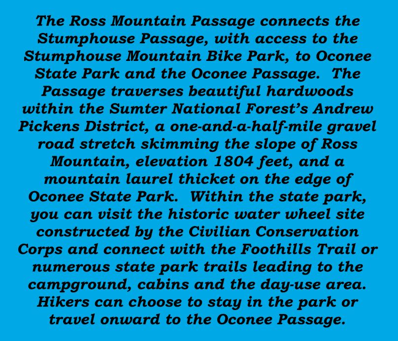
- Ross Mountain Passage
- Oconee Passage
- Stumphouse Passage (1.5 Mile Hiking Trail & 9.34 Mile Mountain Bike Park)
- Eastatoe Passage
- Blue Ridge Electric Co-Op Passage (Jocassee Gorges)
- Roundtop Mountain
- Middle Saluda Passage
- Saluda Mountains Passage
- Poinsett Reservoir Passage
- Blue Wall Passage
- Peach Country Passage
- USC Upstate Passage
- Hub City Connector
- Cedar Springs Passage
- Croft Passage
- Glenn Springs Passage
- Blackstock Battlefield Passage
- Enoree Passage
- Lynch’s Woods Passage
- Newberry Passage
- Peak to Prosperity Passage
- Capital City Passage
- Fort Jackson Passage
- Wateree Passage
- High Hills of Santee Passage
- Lake Marion Passage
- Santee Passage
- Eutaw Springs Passage
- Lake Moultrie Passage
- Swamp Fox Passage
- Awendaw Passage


 ...
...
Oconee Passage
3.73
Miles


Oconee Passage begins in Oconee State Park and ends at Oconee Station State Historical Site, a backcountry military garrison and trading post from the...
Stumphouse Passage (1.5 Mile Hiking Trail & 9.34 Mile Mountain Bike Park)
1.5
Miles


Located in Walhalla, Stumphouse Mountain Bike Park is a state-of-the-art mountain biking facility and the only such recreational facility open to the public in...
Eastatoe Passage
4.6
Miles
 About the Eastatoe Passage:
As you head out on the Eastatoe Passage from the Dug Mountain Fishing Access parking...
About the Eastatoe Passage:
As you head out on the Eastatoe Passage from the Dug Mountain Fishing Access parking...Blue Ridge Electric Co-Op Passage (Jocassee Gorges)
12.6
Miles
Roundtop Mountain
5.9
Miles

Roundtop Mountain Passage including the new Carolina Hemlock Loop trail
This round-trip hike of approximately 5 miles begins and ends at the Sassafras Mountain parking area. The...Middle Saluda Passage
11.1
Miles

NOTICE:
The Eastern section of the Middle Saluda Passage, which includes a section of the Hospital Rock Trail and the Falls Creek Falls Trail at Jones Gap is CLOSED TO ALL...Saluda Mountains Passage
9.1
Miles
NOTICE: Logging is currently underway between Talisman Camp Trailhead and Bell Mountain Road
Saluda Mountains Passage runs along the ridge defining the northern perimeter of the Poinsett Watershed and...
Poinsett Reservoir Passage
6.6
Miles
Poinsett Reservoir Passage travels the mountain ridges along the northern boundary of Poinsett Watershed. This pristine watershed of 19,000 acres contains the headwaters feeding Poinsett Reservoir of the Greenville Water...
Blue Wall Passage
14
Miles
NOTICE:
During this time, there is a surge in Trail usage across the state. We ask that if you are hiking the Blue Wall Passage that...
Peach Country Passage
14.1
Miles

Notice:
Howard Gap Rd. at the intersection of Windmill Rd. and N Howard Street has been closed and the street sign removed. The Peach Country Passage still...
USC Upstate Passage
2.2
Miles

Notice: USC Upstate Passage is now open from the Rampey Center Trailhead to the connection with the Hub City Passage. The North Loop is still closed while...
Hub City Connector
12
Miles
Notice: Palmetto Trail directional signs have not yet been installed in downtown areas.
The Hub City Connector is about nine Trail miles of greenways, bicycle lanes, and safe, signed sidewalks through...
Cedar Springs Passage
2.9
Miles
Although the Cedar Springs Passage is among the shortest passages of the Palmetto Trail at 2.9 miles, it has several unique features serving various user groups. The first...
Croft Passage
12.6
Miles


Croft Passage is a roller coaster for hikers, cyclists, and equestrians (watch signs for designated areas) through historic Croft State Park. Near the southern trailhead, the 65-foot “Advance America” Bridge—the...
Glenn Springs Passage
7.3
Miles
Rolling farmlands, mature forests, and the historic town of Glenn Springs highlight the Glenn Springs Passage. In the 19th century, Glenn Springs was known for the health benefits of its...
Blackstock Battlefield Passage
1.3
Miles
Blackstock Battlefield Passage offers 1.3 miles of nature trails along a remote section of the Tyger River where Revolutionary War patriots defeated the British. On November 20, 1780, patriot militia...
Enoree Passage
36.88
Miles
NOTICE: Indian Creek bridge is CLOSED
Enoree Passage is 36 continuous Trail miles through Sumter National Forest, linking Newberry, Laurens, and Union counties. The southern trailhead is located at the end...

Lynch’s Woods Passage
4.9
Miles
Just outside the charming city of Newberry, lies this beautiful park full of old growth trees and gently flowing streams. Lynch’s Woods Park, originally created in the 1930s by the...
Newberry Passage
10.7
Miles
NOTICE: Mile 8 through mile 9 of the Newberry Passage will be closed from January 15 through February 29 due to repairs on the bridge over I26. The road itself...
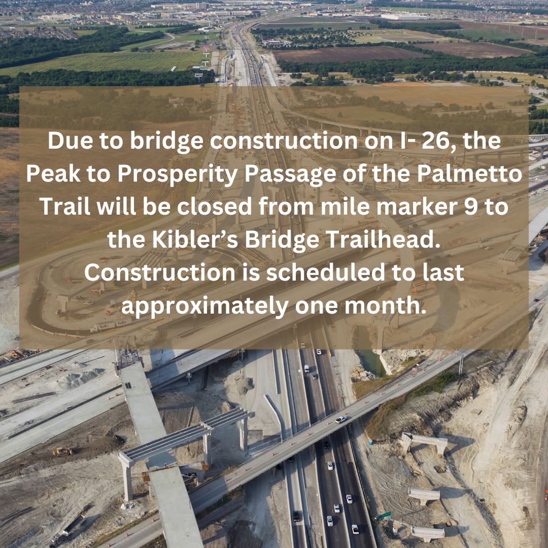
Peak to Prosperity Passage
10.7
Miles
Capital City Passage
10.2
Miles
NOTICE:
Due to the current situation abroad, we have been advised to notify hikers that Fort Jackson Passage and the Capital City Passage terminus will not be allowing pedestrians through...
Fort Jackson Passage
16.3
Miles
Fort Jackson Passage takes you through the heart and into the woods of this spectacular military facility. Fort Jackson was established in the year 1917 to answer the call for...
Wateree Passage
11.4
Miles
The Wateree Passage begins in Poinsett State Park then continues through a section of Manchester State Forest traveling along the remnants of the old SC Railroad through Sumter Junction....
High Hills of Santee Passage
11.4
Miles
NOTICE: The area between Guardrail Road and Fuller Earth Creek Road will be logged at some point in 2020. There are orange flags designating the area to be...
Lake Marion Passage
35.9
Miles
Notice:
The 301 Bridge is now OPEN to pedestrians. Please note that large events are prohibited due to structural weight limits.
There...
Santee Passage
13.9
Miles
REROUTE INFORMATION: On Hwy 210 take a right on Avenger Drive where Macon Rd and Avenger Drive intersect Hwy 210. Stay on Avinger Drive and take a right...
Eutaw Springs Passage
21.3
Miles
Eutaw Springs Passage pushes through a varied terrain of grassy pastures and shady dirt roads, past the site of the Revolutionary War Battle of Eutaw Springs, and through tiny downtown...

Lake Moultrie Passage
26.7
Miles
CAUTION:
logging may be occurring between Viper and Springwood road along the trail. The trail is on the woods road not in the woods so mostly dealing with...Swamp Fox Passage
47.6
Miles
Halfway Creek Trailhead – The parking area off of Halfway Creek road was originally designed as a trailhead and does not have the infrastructure to support a trail...
Awendaw Passage
7.1
Miles
NOTICE:
Due to the land being sold and development the trail was routed down US-17 to Rosa Green Rd. Please use US-17 and Rosa Green Road. It NO LONGER goes...