About the Eutaw Springs Passage
Region

Difficulty

Length
Activities


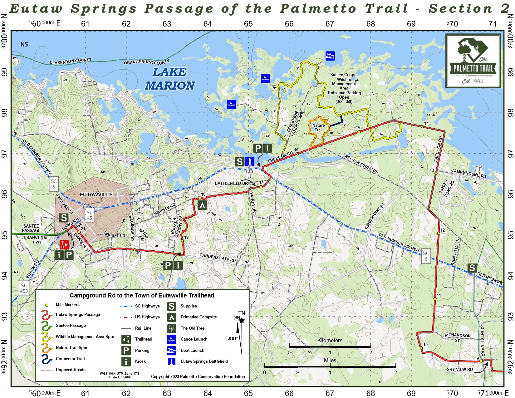
Eutaw Springs Passage pushes through a varied terrain of grassy pastures and shady dirt roads, past the site of the Revolutionary War Battle of Eutaw Springs, and through tiny downtown Eutawville. Close to Eutawville, the passage crosses the old pastures of a former dairy farm. A spur trail off Fredcon Road meanders through Santee-Cooper Wildlife Management Refuge and takes adventurers through lowlands to the southern edges of Lake Marion. The northern trailhead is at the Eutawville Community Building, close to downtown shops and friendly people.
*Refuge spur trail adds about 5 miles
Signs
Interactive Maps Without Wifi
We have partnered with Avenza Maps in order to offer interactive maps that don't require an internet connection. Using the Avenza App, you can download maps onto your mobile device before you hit the trail, so that you locate yourself and be aware of where you are, even in the remotest of places. Offline location helps you stay on track, on the trail, and out of potential danger.
Get the Map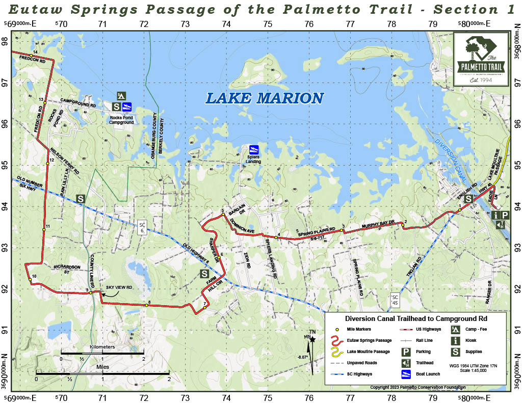

Directions
Eutawville Trailhead (western): Take I-95 to exit #98 and go east on SC 6 (away from Santee) for 10 miles. At intersection with SC 45, turn right onto Porcher Rd for 0.6 mile. Trailhead parking is on left at Community Building. Note name change from Porcher Rd to Eutaw Rd. If you reach the Y-intersection with the IGA Food Store in fork, backtrack 0.1 mile.
Eutaw Springs Battleground Trailhead (middle): Take I-95 to exit #98 and go east on SC 6 (away from Santee) for 12.4 miles to Eutaw Springs. The battlefield and parking are on the left just before Fredcon Rd (S-38-137).
Diversion Canal Trailhead (eastern): From I-26 exit 194, drive east on Jedburg Rd (S-8-16) to US 176. Cross 176 onto Cooper Store Rd. At 3.5 miles bear left and stay on Cooper Store Rd 9 miles to SC 6. Turn left and travel north 16.6 miles past Cross to SC 45. Turn right (east) toward St. Stephen. Travel 3 miles and turn right onto Eadie Lane (first dirt road after cross Diversion Canal). Follow Eadie Lane to the parking area along the canal. On foot or bike, travel back to SC 45, turn left and go 0.7 mile across the pedestrian walkway over the canal to Murphy Bay Rd. Turn left to continue on Eutaw Springs Passage.
Camping
Primitive backcountry camping is available on the dairy farm property off Battlefield Drive (no water). Tent sites and RV camping are available at Rocks Pond Campground, ph (803) 492-7711.
3 night maximum on camping in primitive sites
Notes
- Santee-Cooper Wildlife Management Area is open March through September, and may be muddy or flooded at times. Watch for signs.
- Wear bright colors and reflectors for safety when traveling on country roads.
- Unleashed dogs live along the roads.
Additional Information
- Hiker-recommended for supplies and phone recharge—Cross Food Mart, 1883 Old Hwy 6, Cross, SC 29436, ph (843) 749-0739
- Great local fare and staff favorite (including ’gator and shrimp)—Becca’s Soul Food, Eutawville, SC, ph (803) 492-9526
Places to eat:
- The Twirl – 12223 Old No. 6 Hwy/Eutawville, SC 29048/ (803)492-3419
- Subway – 12340 Old Number 6 Hwy/Eutawville, SC 29048/ (803) 492-7270
Eutaw Springs Passage Share Owners
Woody Binnicker
South Carolina Society Children of the American Revolution